

Initial concepts for a Sandy Springs trail master plan include building 17 miles of multi-use paths across the city and two pedestrian bridges over the Chattahoochee River.
The ideas were drafted by the PATH Foundation, a nonprofit that has overseen the construction and design of hundreds of miles of trails in the metro area, and revealed at a June 19 public meeting. The foundation will use public input from the meeting to create a draft master plan before eventually creating a final version that will go to the City Council for a vote. The study was funded by the city and the Sandy Springs Conservancy.
The master plan will include a recommended “model mile,” or pilot project, for the city to start with that will show what kind of benefits the trails could bring. It will also include cost estimates.
The city is also planning to conduct a separate study specifically on building trails along the Chattahoochee River. That study came out of recommendations from the North End Revitalization Task Force, which created report with six ideas to spur redevelopment in the area last year. It also recommended creating the “Greenline,” a multi-use trail on the north end.

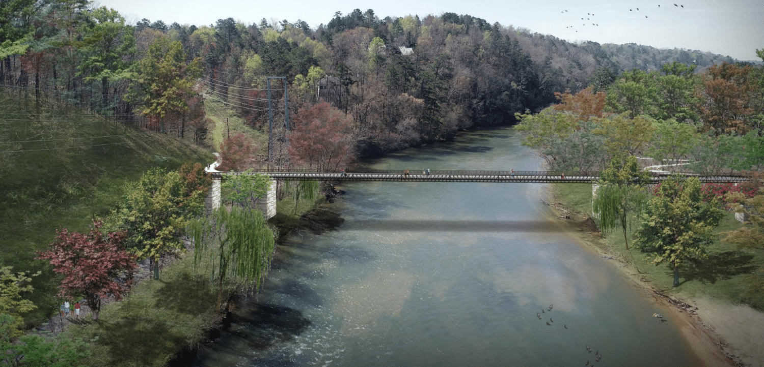
The initial concepts include 17 miles of trails and some major projects like a boardwalk over Orkin Lake, which is south of Morgan Falls Overlook Park, and new pedestrian bridges over the Chattahoochee River to Cobb County and at Roswell Road.
Both bridges have previously been proposed, but plans have stalled.
The routes seek to provide connections to destinations like City Springs, the new arts and civic complex, Morgan Falls, Abernathy Greenway and PATH400. Chastain Park is notably missing because there isn’t enough available land to make that connection, said Greta deMayo, a planner with Kaizen Collaborative, which is working with the foundation on the master plan.
The trails would also connect to Sandy Springs Charter Middle School, Ison Springs Elementary School and North Springs Charter High School.
The pilot project has not been determined, but deMayo said a top contender could be trails connecting to Marsh Creek and the Sandy Springs Tennis Center because it could build off work the city has already done in that area.

The trails would either be 12-foot-wide greenway trails, 10-foot-wide side paths or 6-foot-wide sidewalks with shared-use roads, called a “neighborhood greenway.” The type depends on the amount of space available.
“We don’t want to acquire 10 feet from everybody’s front lawn. It’s not feasible and so disruptive,” said Ed McBrayer, the executive director of PATH Foundation.
The plan would require purchasing some private property to build the trails. Building the model mile and showing that the trails would be successful will convince owners to sell the property, McBrayer said.

The trail would need to cross Roswell Road at grade near Big Trees Forest Preserve. A landscaped median and traffic light would be added to allow people to cross safely, deMayo said.
Another complex area that may have a trail is Colquitt Drive, which runs parallel to Ga. 400. The Georgia Department of Transportation plans to widen the highway to add toll lanes, but deMayo said the agency is aware of the concepts.

About 75 people attended the meeting and many who spoke were supportive of the ideas.
One resident and avid cyclist who was in an accident with a car on Roswell Road urged people to support the trails.
“I encourage everybody to get behind this effort because it is very, very important,” he said. “We need trail for the safety of people.”
Comments on the proposal must be submitted by July 1. For more information, visit the city’s webpage on the project.
This story has been updated with additional information.